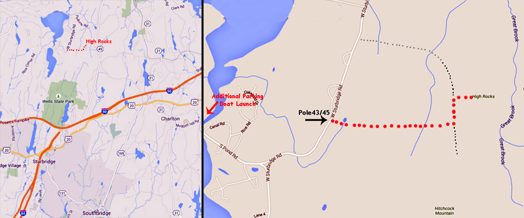
Directions
High Rocks is located in East Brookfield, Massachusetts and is 60
miles/1hr 8min from Providence. Depending where you are in Rhode Island
get to
RT 90 (Mass Pike) and take exit 9 to Rt 20 then north on New Boston
Road. This turns into West Sturbridge Road. Carefully look for pole
43/45 and park there. There is only room for one or two cars. There is
additional parking on South Pond Road at a boat launch site. Find the
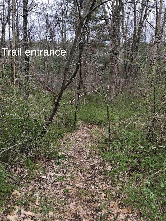
faint trail in the woods on the east side of the road (photo
below). The trail
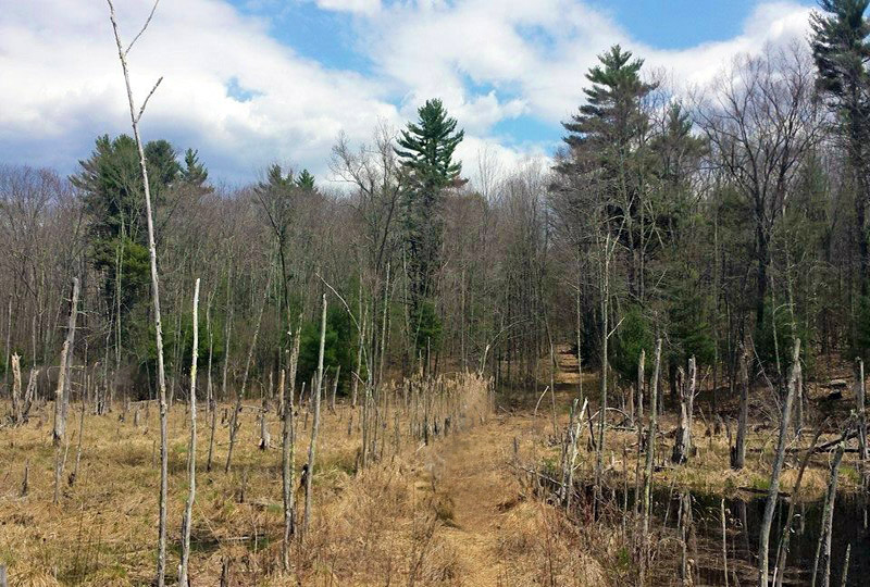
opens up to a swamp (photo below) and becomes more distinct. Follow
that
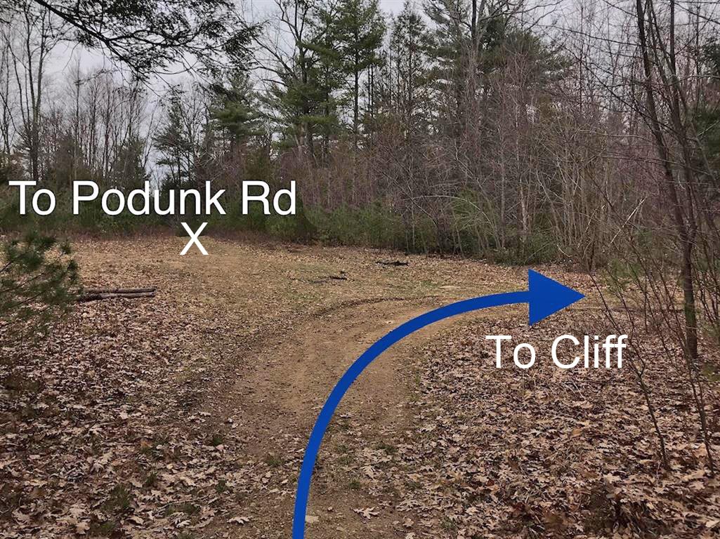
until the junction with another distinct trail/road. Take a left on the
trail and follow to a clearing. Take a right at the clearing and follow
to the top of the cliff. Reverse the approach to return to your
car. Do not take the trail to Podunk Road as it is on private
property and posted.
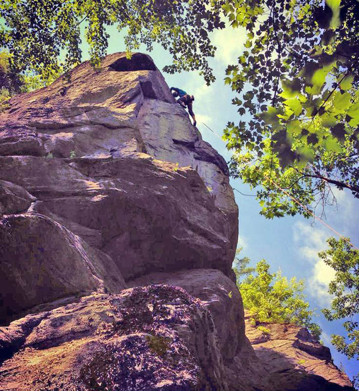
Protection Bring long webbing or a
static rope to set up top rope anchors. There are a few routes that can
be led with decent pro. There were bolts here but they were chopped by
a self-appointed arbiter of climbing ethics.
Access
The cliff itself is on state land but the access is across private land. Please be respectful of that.
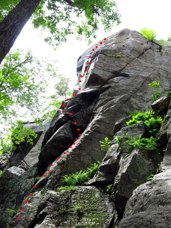
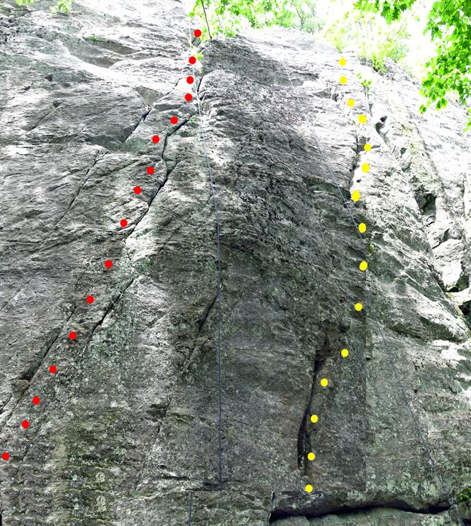
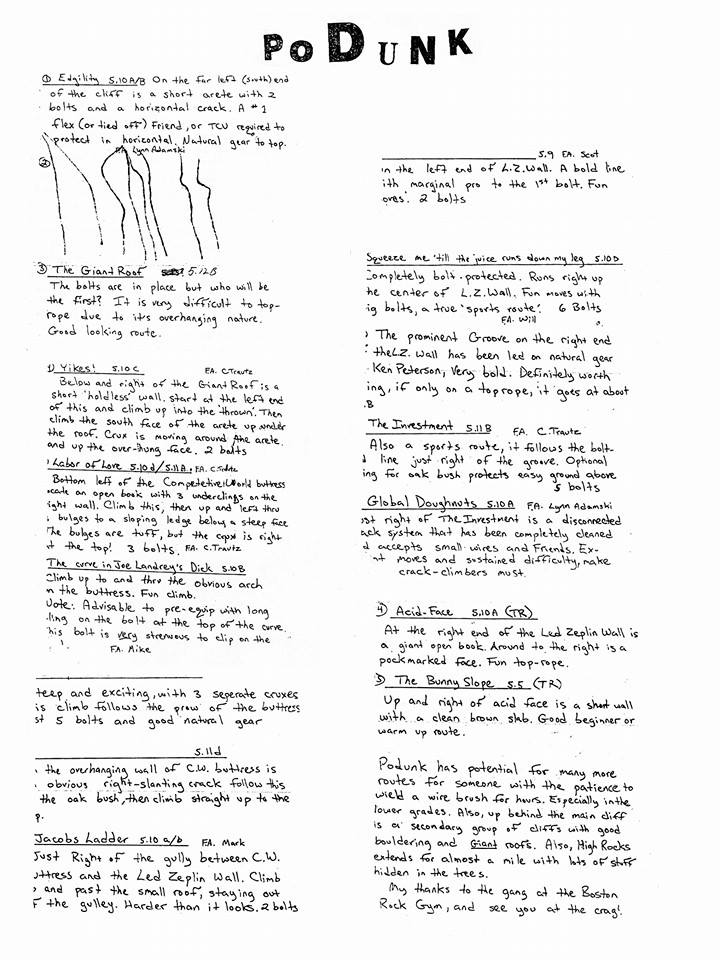
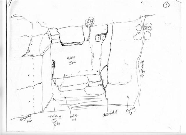
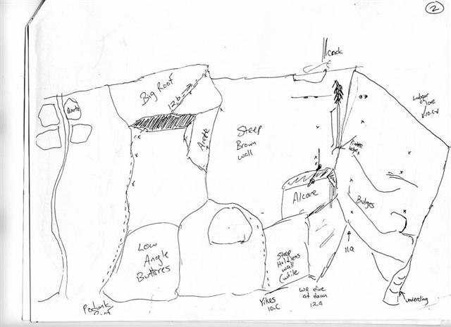
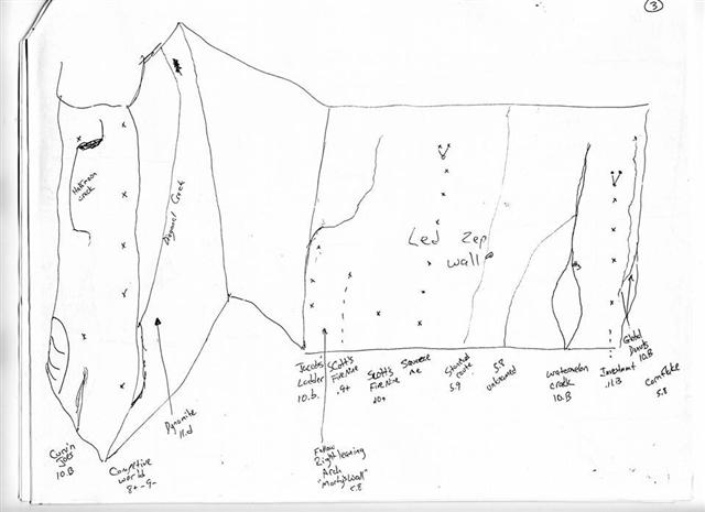
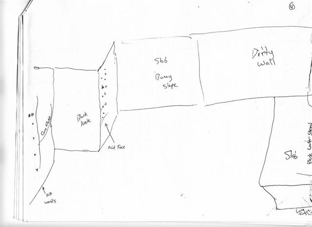
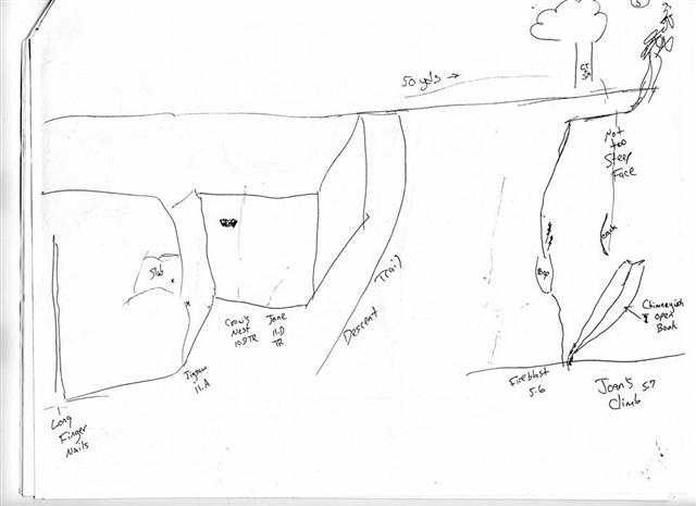
Routes
The cliffs are about 30 to 70 feet in height. The gneiss offers, for
the most case, solid rock. Routes range from crimpy slabs to
overhanging jugs, and a few cracks.. There is no conclusive information
as to who first climbed many of these routes. What route history is
known is detailed in the crude Podunk guidebook below.